I got it into my head that I would circumnavigate Santa Catalina Island by myself on a SUP. Once I had the idea, and thought about those miles of gorgeous uninhabited shoreline and glorious solitude, I could not dislodge the notion.
The untamed part of the island called to me. I longed to paddle around the west end tip of the island, make that left turn, and paddle the wild and untouched backside. There, open ocean swells that had traveled thousands of miles across the Pacific met their demise, shattering like glass on cliff walls.
The backside has approximately 30 miles of untouched coastline. There is only one place to stop and camp there, at about the midpoint, at a place called Little Harbor Campground. So, if you’re going to paddle the entire length of the backside, there is but one spot to stop and rest for the night.
Logistics:
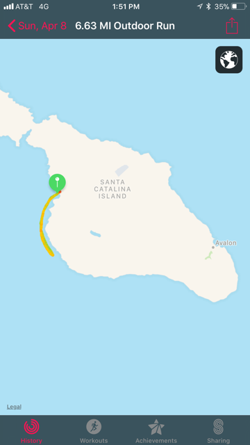
The idea was to do it in three paddles over two days. The plan was this: I would take a boat to Two Harbors on the first day, and paddle from there to Parsons Landing Campground, which is only about 5 miles.
On Day 2, I would paddle from Parsons Landing around the west end of the island to Little Harbor, which is about 15 total miles from start to finish, depending on how close you hug the coast.
On Day 3, I would paddle from Little Harbor all the way around the backside of island and to the front, to Avalon, about 18 total miles. I would catch a boat home from Avalon. The total mileage was roughly 40 miles in 48 hours over 3 separate paddles. This was not an actual circumnavigation of the entire island because I was skipping the middle chunk of the leeward side. (Perhaps in a future trip, I would paddle the entire island, front and back).
I picked a weekend in early April, 2018, and that was my first mistake.
Paddle No. 1 (to Parsons):
I arrived at Two Harbors around 11am, pumped up my inflatable board and got my drybag stowed. The one drybag had everything I needed: my tent, sleeping bag, food, stove, clothes, etc. [For packing details, see my post regarding Paddle Adventure Gear Checklist.]
I had a short paddle ahead of me to Parsons. From my review of google maps, I plotted out the paddling distance as 4.5 miles or so. I figured I would be traveling three and a half (or so) miles per hour so I was not concerned about the first paddle.
I launched into the harbor and was off. As I paddled out and headed west, the swells were larger than expected and running east down the length of the mainland side of the island. The wind was fairly strong as well as afternoon loomed.
With the 40 lb. drybag tied down in front, it makes for a semi-high profile on the board, and the wind pushed against it and slowed me down considerably. I pressed on through Emerald Bay and eventually came to a rocky point, from which I could not see around. Because I was so close to the point, with perhaps only 15 feet to the cliffs on my left, I encountered some surf and I decided to get away from the rocks and give myself some steadier water, even if the wind and current might be worse.

Once I passed the point, a bay quickly opened up behind me and to my left. Surrounding the bay, gray and rocky cliffs perhaps 150 feet straight up appeared. I stayed on the outside, far from the cliffs, and kept going straight across. I noticed what appeared to be a large sandy beach, but from my vantage point, now that I was far from shore, it was not clear to me that this was Parsons Landing. I could not see any people, campsites, tents or benches. I checked my watch and I was not yet at 4.5 miles so I kept going. The watch was wrong.
I paddled past Parsons until I realized I had gone too far. Thankfully, I remembered hearing on a podcast that navigation on your phone should work even if you do not have cell service. I checked my phone and the navigation did work, even without service. I now knew where I was, and I happily noticed I was being rapidly pushed backward. The wind and swell, working together, were pushing me back to Parsons without me lifting a finger. I could sit back and enjoy the ride.
I stood up, spun the board around, and started paddling in easy fashion back to the campsite. In no time, I was pulling into Parsons. I landed through the mild surf and dragged the board on shore.

I enjoyed a quiet afternoon and evening at the campsite, which is just feet from the water. I ate my dinner by the fire, and drank a small box of Cabernet, which was surprisingly good. The wind picked up and I took shelter in my tent for an early night’s sleep. The plan was to get up early and hit the water first thing, so sleep was critical.

Paddle No. 2 (Parsons to Little Harbor):
I was up at dawn. The ocean was calm, thankfully, and no wind could be felt. An eerie fog descended on the island and visibility was about 100 yards. The fog gave me comfort because that usually means calm seas.
I was at the West End in less than an hour and excitement welled up within me. I had daydreamed about making this turn. Just before I reached the outermost tip of the island, the shoreline opened up into a small, deep bay, with sheer skyscrapers of rock jutting out of the water.
Once I was out of that deep bay to the tip, large waves suddenly rose up out of the sea, surprised that their long journey had been abruptly interrupted by the appearance of a volcanic island. With their underwater momentum shoved toward the surface, the waves shot up and exploded on the West End’s craggy rocks.
My body tensed and readied itself for a battle. I decided to paddle hard out to sea to get around this turbulence. Behind me, I could hear the sound of a deep sea cave. First, I heard a loud “whomp” as the rearmost wall of the cave was walloped by a large underground swell. Then, a second later, I could hear the sound of the cave vomiting out the invasion of sea and foam. I was on high alert, and my eyes darted here and there for sideways ripples that might topple me into this frothing water.
In hectic conditions like these, I was not exactly soaking in the moment as I got my first sight of the backside of the island. Eventually, however, I was out of the worst of it, about 150 yards east of the tip, and I stopped and enjoyed the moment. Kelp beds were littered everywhere, and their long brown fast-growing leaves laid sideways on the surface. Harbor seals, several of them, poked their heads up out of the water and secretly surveilled me.
I floated about 50 yards from the cliffs and ate a snack. The cliff face was still ricocheting swells back at me but the violence of the West End was behind me. Ahead, looking East toward my destination, I still had about 12 miles of paddling, but I could only see a few hundred yards ahead. The fog still hung thick about the island. To my direct right, about 200 yards from the shore, a huge ominous rock, covered in white stains of innumerable birds over the millenia, protruded about 50 feet out of the water. It was Eagle Rock, although only pelicans were gracing it at the time.

The coastline drew near and drew far from me as I traveled east down the coast, in and out of the fog swirling about me. It became very quiet and only an occasional gull could be heard over the gentle sounds of my board’s wake and paddle strokes. I steered a straight course down the coast and after another two hours or so, it was time for lunch.
I stopped for a lunch in a small cove in Lobster Bay. When I entered the cove, I terrified a harbor seal lazing on a rock. The seal freaked out in comic fashion, belly-flopped into the water, and vanished. I laughed out loud.
“Sorry buddy.”
After a short rest, some toe wiggling for circulation, and lunch, I moved on, figuring I had another hour or so ahead of me. When I paddled out of the bay, the fog suddenly burned off and the sun came out. The coast fell away from me and darted inward toward my left. I could see Catalina Harbor, which meant that I was now even with Two Harbors on the other side of the island.
A choice presented itself at this point. I could stay near the coast which would add mileage as I paddled with the coastline’s idiosyncracies. Or I could proceed as the crow flies directly to Little Harbor, which would take me a good ¾ of a mile or more from shore. I opted for the straight-line approach and found the water was calmer further from shore.
In time, and with my hands, butt, and shoulders griping, I paddled into Little Harbor. Once I got around some surf at the harbor mouth, I had an easy landing in the protected cove near the campground. I congratulated myself as I arrived. Stage 2 was done.

As I sat watching the fire that night, I worried about Stage 3. The forecast of wind and swell, which I had studied before I had left, had not been promising.

Paddle No. 3 (Little Harbor to Avalon):
I awoke in the middle of the night, several times. Each time I did, I thought the surf was getting louder. The wind was evidently picking up too, beacuse my little backpacker tent was being buffeted in the dark.
“Shit,” I said out loud in the dark to the rattling tent walls.
I walked out to the water’s edge to take a look at dawn. But tucked away inside the harbor, it was difficult to tell what the conditions would really be like out there.
“Well, I’m here, so here goes,” I said to myself.
I broke camp, and ate a horrible breakfast by adding boiling water to an egg scramble in a bag. I barely got it down, and loaded up.
I paddled due west out of the harbor, working hard to stay upright as I was being buffeted by the waves coming from seemingly every direction. I told myself it would be better when I got out of there to open water. It wasn’t.
When I got out of the harbor, I needed to head south but I did not want to be too close to the coast because I knew that these large swells, which were westerly, would be pulverizing the west facing cliffs on this part of the island, and would be sending the backwash out to sea. This would mean I would be dealing with swells on both my left and right.
On the other hand, I did not want to get too far from the coast and be subject to the steady northwest winds which might have their way with me and push me off course, or make it exceedingly difficult to start heading east when the island’s coastline fell away that direction.
So I tried to find a compromise route, one that was not too far from the coastal cliffs, but not too far out to sea. I settled on about a ¼ mile from shore and then started following the coast in a southeast direction.
The chop never let up. I paddled for a mile and was using a lot of energy just to stay upright. Periodically, a swell would suddenly whack me from the left, from the coastal side, and catch me off guard. Several times I lost my balance and barely recovered by throwing my paddle down flat on the water’s surface, which arrested my fall, or by stepping back and regaining my balance. I did not have any difficulty balancing on the previous two days.
I decided I would keep going to see if the conditions improved. I knew that approximately 4 miles from Little Harbor, the coastline would fall away to the east, which would potentially make my paddle a lot easier. I surmised that once I got to that point, the westerly swell would be at my back and become my friend. I would be able to ride it most of the way back to Avalon. That made sense, right? But I didn’t know that for sure. I had never been there.
While I wrestled with these thoughts, a swell of backwash came from my left and a westerly open ocean swell came from my right, and they both crested under my board simultaneously. It was like being at the center of Poseidon’s hand clap. The two waves rose together and splashed me straight up, violently shooting the board and me up and sideways. I fell back on the board, dropped to my knees, and one leg fell into the water. Hardly knowing what happened, and wondering at first whether something had hit me, I looked around and got my bearings.
To my right, large swells rolled in every three seconds. They were well above my head while I sat there, probably four or five foot swells, and tiny little white waves of windchop appeared at the top of each one. From time to time, a large set would arrive and the swells were much larger than that.
I looked to my left. I could see massive spouts of foam and spray a ¼ mile away on the face of the cliffs. A second later, a muffled thump could be heard, which sounded like a distant bomb exploding. After the explosion, the wave would reconfigure itself and head back toward me.
The wind was loud in the hood of my windbreaker. Everywhere, the sea was worked up and frothy.
I decided if I was going to keep going, I would have to do so on my knees. So I tried this new strategy, and with my knees planted on either side of the board as far as they could go, I choked up on the paddle and started paddling. I checked my watch and saw I was (about) 2 miles out of Little Harbor, and that in just about 2 more miles, I had a theoretical shot of a complete change of conditions. And hey, after that only 14 more miles to go to Avalon, I joked to myself.
But then a voice in my head said, “Yeah, but what if conditions don’t improve?”
“Shut up,” I said.
And then things started to get unpleasant. I started to feel sick. Nausea washed over me. I started to regret my complete dogshit choice of a scrambled-eggs-in-a-bag breakfast that morning. I did all I could to ignore the nausea and moved on.
I kept paddling, keeping the breakfast at bay as best I could. At one point, while I was still paddling on my knees, the conflagration of the left and right swells happened again, and in a sudden lurch, I was thrown violently off of my knees and forward on to my drybag which was stowed in front of me. I was completely laid out on top of it, with each arm on either side of my bag, one hand clutching my paddle.
I yelled out to the cruel sea, “C’mon now! That was uncalled for.” The sea did not seem to notice my indignation and carried on.
At mile 3, as this nonsense continued, and I wondered how long it would last, I heard my wife’s voice. Just before I left, she said, “Just promise me you won’t be too proud to turn around if it gets dangerous.”
“Of course, I’ll turn around if it gets dangerous.”
“Promise me.”
“OK, I promise.”
This promise kept replaying in my head and as my nausea doubled, I came to terms with the fact that this was not a good day to do this. So, when I was only about 3 miles and some change out of Little Harbor, I turned back.
It was a difficult decision for me. I had told everyone I was going to paddle all the way around the backside, and back to Avalon. And I was posting my progress on social media. I did not want to fail, and especially not publicly, and then have to explain why I failed.
But it came down to the fact that I had no idea if conditions would improve at mile 4, that I was about to puke, and that if I puked, I may not have the strength to complete the paddle to Avalon, and that I did not want to have to pay $25,000 to cover a helicopter rescue bill. And receiving an “I told you so” while I’m landing on the mainland in a Coast Guard helicopter would probably ruin all future endeavors of this nature. So, I admitted failure and turned around.
Almost immediately after I made the decision to turn the board around, I puked up the dehydrated eggs. Then I started laughing. The whole thing was ridiculous. I watched the breakfast as it was swept away, washed out my mouth, and paddled on.
The choppy paddle back to Little Harbor was as grueling as it was on the way out. The entire sojourn ended up being only a little more than 6 miles.
Once I was back in the harbor, I sat on my butt and put my feet in the water. My knees and toes were chafed and bleeding. I let the waves push me in and felt defeated.
While I got my board off the beach, and tried to get some food and water down my gullet, a nice man who felt compassion for me arranged for me to take a bus back to Two Harbors where I could catch a boat home, which was sweet. And that is what I did.
The Lessons of Failure:
I failed. As the weeks and months went by after the trip, the failure felt like a knot in my gut. It bothered me, a lot. When I saw the island off in the distance while sitting on the beach at home or paddling around Newport Beach, it made me a little mad, like the eastern side of that island was mocking me from 26 miles away, laughing at my laying an egg out there.
I shook my fist at the island and vowed to do it again. But this time, I would be better prepared because I had learned a few things. One, I learned something about my limits, about fear and danger, and about listening to the voice of reason. Two, I learned not to eat eggs before a paddle. Three, and most critically, I learned that picking the right time to undertake a mission like this is everything. If the weather is not right for it, you are hosed. Next time, I would pick the right weekend, or at least the weekend most likely to have calm seas.
But later, over a year after my failed attempt, and as I prepared to make the attempt again, I looked at the failure a little differently. I saw myself out there on that third paddle. The wind was howling. The waves were exploding on the cliffs. The swells were rolling in. The whitecaps were capping. There was not a single boat or other person in sight for miles and miles. On the lonely side of Catalina, far offshore, my lonely ass was on a standup paddleboard, hunched over on my knees, head over the side, barfing my guts out.
When I think of that scene, I don’t think, “What the hell was I doing out there?” Instead, I think, “Man, I was absolutely killin’ it that day!”
[Coming Soon – How I Succeeded in Circumnavigating Catalina]

Hi I am so happy I found your blog, I really found you by accident, while I was browsing on Bing for something else, Regardless I am here now and would just like to say thanks a lot for a remarkable post and a all round thrilling blog (I also love the theme/design), I don’t have time to read it all at the moment but I have saved it and also added your RSS feeds, so when I have time I will be back to read a great deal more, Please do keep up the great job.
LikeLike